
Haycreek 'Road'
I know that I really shouldn't be writing about this. As they say, if you call some place paradise, kiss it goodbye. But Haycreek Road (I call it Haycreek, as one word, but the real name is Hay Creek Rd.) is very much part of who I am today. I believe the first one to discover this road within my circle of friends was Exkalibur. He apparently drove down the road in his dad's car, and wrecked the transmission. Then it was Jeff and I who rode down it in his Jeep. and eventually I brought my Van up to test it on the rugged logging trail.

Now, surely there are elite Jeepers who will say, oh hell, thats nothing. But for a Van, that is a very difficult place to get to. Haycreek is basically a mix between a muddy trail, and a rocky trail. Half the time you are driving in mud, the other half you are driving over bedrock. The trail roughly follows the hydro lines, and was originally cut out to service them. However, now that Hydro One uses helicopters to service these lines, the trail has fallen into disrepair. The trail (or 'road') runs through Algonquin Park. Technically you need a park pass to be able to travel on the trail, as far as I am aware. It passes through 2 ecological zones. The north eastern zone closer to Whitney is in the coniferous region of the Canadian Shield. The Canadian Shield is an ancient mountain range which spanned across Pangaea before the continents broke apart. Some say it was the first mountain range on earth. The south western region heads into a mixed forest, dominated by coniferous trees, but with noticibly more deciduous trees. This portion of the trail also enters into Muskoka cottage country. Along Haycreek, you will sometimes see trails leading off into other directions. These trails are old logging trails, and most of them are so overgrown you need a chainsaw to get in. The active logging roads, you will likely need mud tires to get through, because the logging trucks tear up the ground like crazy.

It seems funny to think of logging in Algonquin. A while ago, I wrote an article about it. But I will touch back on that in this article. In Algonquin Park there are over 800,000 kilometers of logging roads and trails. Compare that to say, the city of Toronto, with 450,000 kilometers of streets. Algonquin, while surely almost 10 times larger then Toronto, is still very dense with roads and trails. This is especially true in northern Algonquin, where logging is more present. Of course logging in Algonquin is not clear cut logging. It is selective. And I am sure there will be those who disagree with it, but I think that the logging program in Algonquin is an example that all logging programs should follow. There are a few conflicting reports on the legalities of being on such roads. As far as I am aware, Haycreek Road is an actual road right of way, and you are allowed to be on it anytime. Logging trails, not so much. Logging trails are technically off limits during the work week. On weekends and holidays however, the general public is allowed on any logging road on government controlled land, unless otherwise posted. Finding a posting for the Algonquin Park logging roads is tricky however. They often don't exist and park staff seem to have differing opinions. This older map does suggest that it is illegal to drive on them, but only mentions the closed or abandoned logging roads, and not the active logging roads. So even that is a tad confusing. Typically we never saw anyone out there except Moose. And if you did run across a ranger, I am sure you could play the stupid tourist card - so long as you aren't in there poaching or doing other illegal things, I doubt they would do much.
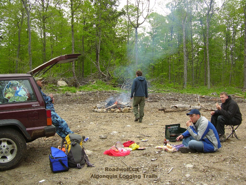
There WAS a map available online, which showed EVERY single logging road in Algonquin. But sadly, some environmental protection group got ahold of these maps, and used them to try to press their case about how logging was bad. Now, thanks to those people, the map is not available anymore. The logging roads are often VERY difficult to navigate, and I wouldn't suggest trying to drive through them unless you have a GPS which can track where you have been. That being said, they are VERY fun to camp at. The unused logging roads have nice clearings every kilometer or so, which you can easily set up camp at. Of course there are no facilities, but its not camping if you have facilities really...

All in all, worth the drive to check out. But treat the place with care and respect.